During this expedition, carried out within the framework of a NWO-VIDI-project, scientists investigate the role of canyons in deep-sea carbon pathways to define if these canyon systems form pathways or sinks for organic carbon. Are these canyons 'conveyor belts' of nutrition for deep-sea organisms? And how do the submarine canyons affect global carbon fluxes and ultimately climate change?
Carbon fluxes between surface waters and the deep ocean potentially have both positive and negative feedbacks on climate change and therefore it is crucially important to understand transport, sequestration and remineralisation processes. Lateral transport of material likely plays a dominant role in the transport of organic matter from the continental margins all the way to the deep ocean, withdrawing carbon from the system over longer time scales.
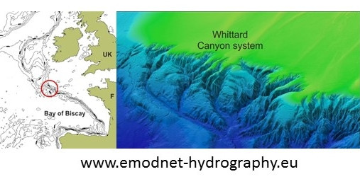
We assume that a lot of this material is channelled through submarine canyons, which could form effective connections between productive shelf waters and the nutrient poor deep-sea. Besides forming conduits, the steep and irregular topography of canyons interacts with the hydrography, resulting in enhanced turbulence and mixing of material. These canyon systems are comparable in size and shape as canyon systems known from land (Grand Canyon) and like their terrestrial analogues provide a multitude of habitats for hotspots of deep-sea fauna.
During the cruise several lander and mooring systems will be deployed at different depths to monitor spatial as well as temporal variability in particle transport. In addition bottom samples and video transects will be carried out to characterise the sedimentology as well as the presence of specific fauna in the canyon and the adjacent slopes.
Furu Mienis, expedition leader
The expedition starts on May the 12th and will finish on the 29th.
Stay up to date via this blog, Twitter @NIOZatSea or Facebook @NIOZnieuws
~~~for the whereabouts of R.V. Pelagia check this page~~~
Blog 9 by Furu Mienis, 28th May
Hundred and one stations....
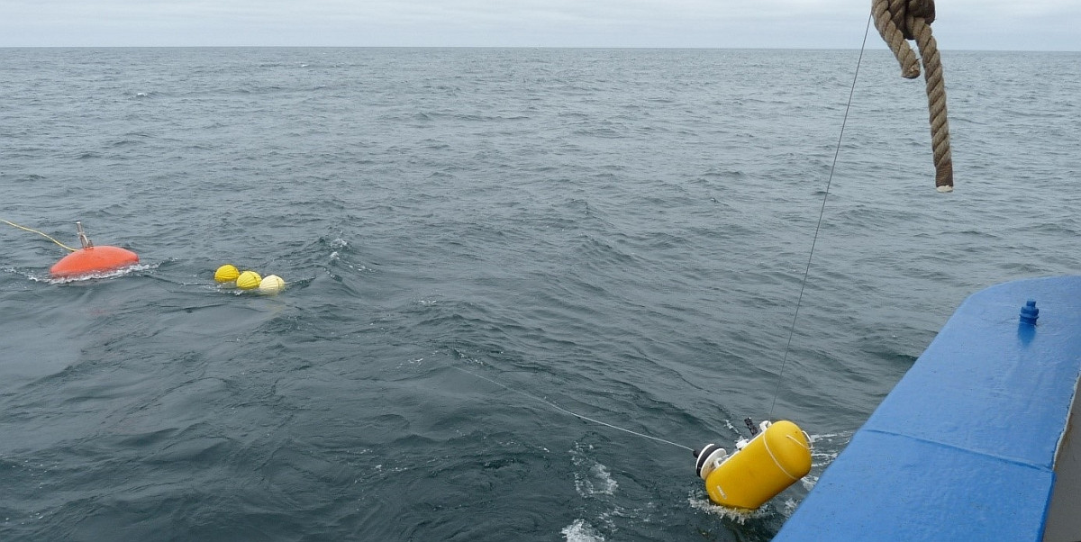
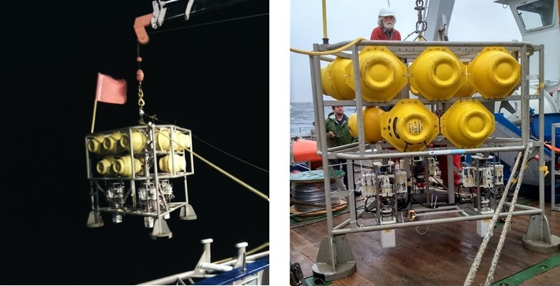
Yesterday we started our transit to Texel and therefore this will be our final blog. In the last two days we have deployed our long-term moorings and a bottom lander. Both moorings are 1500 m long and are equipped with a so called traveller. This traveller travels up and down along the mooring line, recording a profile of temperature, salinity and turbidity. In a way this profile is comparable with a CTD cast, however attaching it to a mooring line will give us the opportunity to study changes through time. Our main aim is to define if particle transport in the canyon is a constant permanent feature or that it happens in episodes, for instance after a stormy period or when trawling occurs along the edges of the canyon. Both moorings and the lander will be recovered in the summer of 2018.
At the moment freezers and fridges are filled with samples, data are copied for safe keeping, boxes are packed and labs are cleaned. We can look back at a very successful cruise with hundred and one stations. We made some amazing video transects, each one showing new features and fauna and we even had some proper cliff hangers. We have collected huge amounts of CTD data, lander data, water and sediment samples, which we will analyse the coming year at NIOZ. Whittard Canyon still has a lot of hidden secrets, so we are looking forward to come back next year!
Blog 8 by Henko de Stigter, 25 May
Hard data and why counting counts
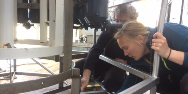
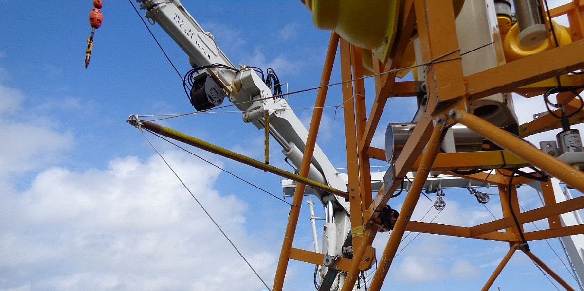
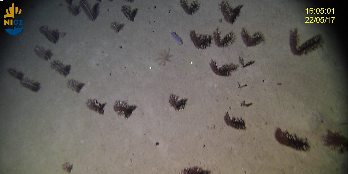
Quantifying is an important aspect of natural science, and this is also very true for our explorations into the depths of Whittard Canyon. Every day we collect loads of quantitative information, and all data are carefully stored in the ship’s logs. Should anyone argue that science is just another opinion, then at least science is a well-documented opinion built on traceable data. And so we count and measure and record every move we make. With the ship’s GPS navigation system we determine our position on the globe to a metre accurate, with the multibeam echosounder we measure the water depth below the ship, with the CTD we probe temperature, salt and oxygen content of the water with three decimals accuracy. During our camera surveys of the seabed we count fish and corals and sea cucumbers and whatever other animals appear in the lights of our camera, and take their size by reference to the bright green laser spots projected for scale onto the seabed. Most of the instruments we are using have been thoroughly tested and calibrated in the lab and in the field, but our cruise also provides opportunities to experiment with new methods and equipment. Ingenuity and improvisation are often required to make things work better. Such as illustrated by the broomstick borrowed from the ship’s workshop, turned into a calibration tool for determining the field of vision of our new particle camera.
Blog 7 by Henko de Stigter, 24th May
Flying lessons in the deep sea
Whilst detailed water depth maps help to find our way through the maze of deeply incised gorges and protruding ridges that make up the landscape of Whittard Canyon, it is only with help of underwater video camera lowered from the ship that we learn to appreciate the variety of underwater landscapes deep below us. Even then, what we see is only what appears in a narrow strip illuminated by the lights of our camera frame. Beyond the reach the lights, the submarine landscape remains in almost absolute darkness, unseen by our curious human eye. Yet, looking ahead in that darkness is absolutely essential while towing a costly camera frame through the rough canyon terrain, keeping it at short distance above the seabed while it is suspended from the ship by a cable of hundreds to thousands of metres length. For that purpose the camera frame is equipped with two sonar heads that continuously scan the seabed ahead of the frame for possible obstacles. Interpreting the sonar images in terms suitable for underwater navigation requires some practicing, however. After two crashes into submarine cliffs over the last couple of days we hope to have learnt enough to avoid a third and potentially fatal crash.......
Blog 6 by Furu Mienis, 23rd May
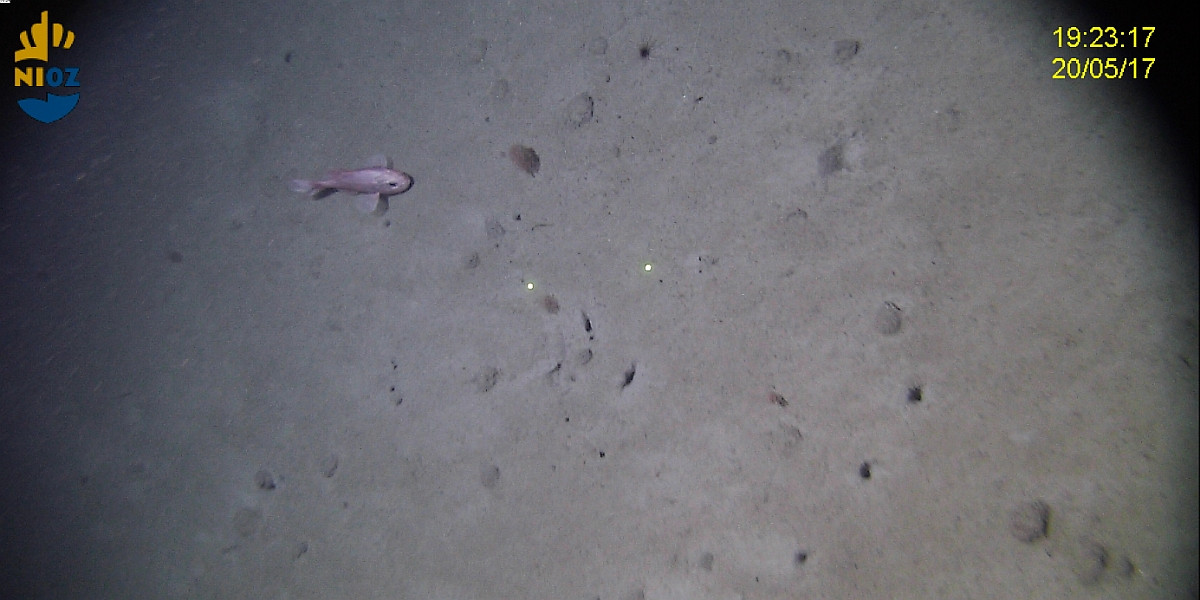
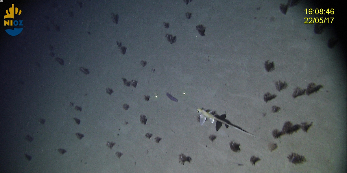
Our eyes under water
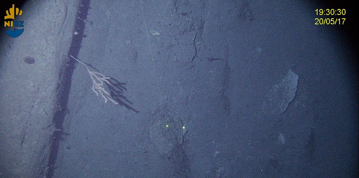
One of the objectives during the current cruise is to study the diversity and density of macro fauna in the Whittard Canyon. It has been shown that canyons are hotspots of biodiversity caused by high levels of food inside the canyon in combination with the heterogeneity of the landscape, creating a multitude of habitats for different species.
To study the underwater landscape and its inhabitants we use a so called tethered camera system. This system consists of a downward and forward looking camera that are fitted in a frame, two lasers for scale, a sonar system to observe obstacles along the way and a temperature and oxygen sensor to measure changes in environmental conditions along the transect. The camera frame is attached to a Kevlar wire and is dragged behind the ship at a constant height above the bottom. Via optical fibres in this cable we have a live view of what we film at the seafloor.
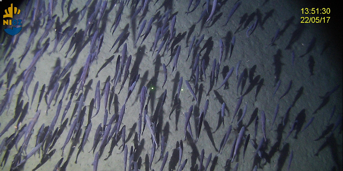
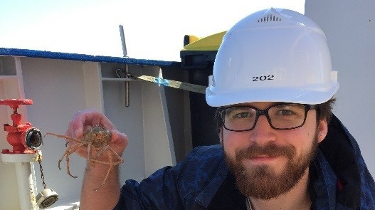
So far we have carried out 6 video transects at different depths in the canyon. The landscape is quite variable ranging from current rippled areas along the bottom of the canyon to the steep slopes which are covered by soft corals, sponges and anemones. In some places the soft sediment on the slope is replaced by rocky vertical cliffs covered by stony corals. We have also seen a large variety of fish species on the sloping part of the canyon, sometimes in large numbers such as Rat Tail fishes and Orange Roughies.
Some impressions of this beautiful and largely unknown underwater world:
Blog 5 by Rob Witbaard, 22nd May
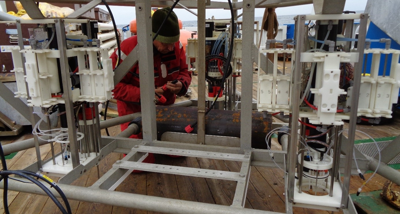
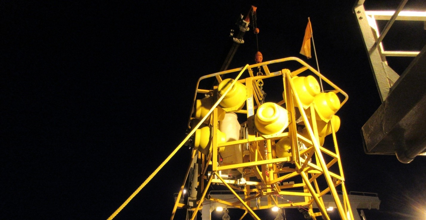
Open heart transplantation of the ALBEX lander
After the second deployment, an inspection of the ALBEX lander showed that all benthic chambers worked properly, except the unit which we had put in as a replacement, two days before. On the basis of the log files produced by the unit we noticed that the hydraulic pump did not work. The hydraulic pump is a kind of heart to the system. It is pumping around the "blood" by which the unit can perform its actions i.e. take samples, close the lid and put the chamber into the sediment. The pump is also physically in the heart of the instrument, and difficult to access. We drained the hydraulic system, took off the syringes and took out the pump. We learned how to open the pump, which was quite an effort. It readily became evident that a broken gear was the reason. We exchanged the pump with that from a unit which was flooded before and reassembled the system. Tests on deck showed that all functions now worked again. On paper this all seems to be a simple exercise but took us most of the afternoon. One thing we cannot test on board is the effect of pressure and temperature. The lander is aimed to do its work at 3400 meter depth. The only thing we can do is deploy the lander and wait until the lander is back on deck again and check if the pump transplant was successful or not….
Blog 4 by Holly Mellor, 21st May
Using traditional methods in a contemporary context
I am currently undertaking an internship with the NIOZ as part of a master’s degree in Limnology and Oceanography based at University Amsterdam. My focus on board the Pelagia is to determine the dissolved oxygen content at different sites throughout the Whittard Canyon. Canyons are interesting as they influence the geology, sedimentology, oceanography, biology and ecology of our oceans.
Benthic landers are fully equipped with many instruments that can be tailored to target the specific research of the scientists on board. The ALBEX (Automated Lander Benthic Experiments) is deployed at carefully selected locations to sample the dissolved oxygen levels (also other parameters) on the sea floor using two different methods.
Optodes are purposely programmed to measure the amount of dissolved oxygen (in- situ) from water that has been isolated in a respiration chamber. Samples are collected and then subsequent measurements can be taken at specific time intervals thereafter so you can determine the oxygen consumption rate over for the time the instrument is deployed. Optodes are the preferred method of collecting this type of in-situ data but are prone to “drift” which occurs as the instrument needs time to compensate for the immense pressure that occurs at depth.
My research is based on calculating the dissolved oxygen levels in waters across the canyon by using the Winkler method that was first used in 1883. This method is still considered as the reference method of dissolved oxygen and for a calibration point for in-situ optodes. Water samples are collected in airtight glass cuvettes (at depth) and are brought back up to the ship where we chemically determine the amount of dissolved oxygen. The Winkler method has the advantage of being able to accurately determine the decrease in oxygen concentration over the period of time the Albex is deployed. This data can then be as an accurate back-up method if the optodes malfunction and to give an accurate start and end point to the data collected beyond depths of 1500m.
As with all science, there are advantages and disadvantages of the methods used for data collection which is why we combine methods to be able to better understand more about the communities and processes that shape the deep sea.
Blog 3 by Áine Shannon, 20th May
My name is Áine Shannon and I am the Irish Observer on board the Dutch Research Vessel Pelagia. Under the United Nations Convention on Laws of the Sea (UNCLOS), it is Irelands duty to place an Irish Observer on board any foreign vessel that is entering its waters.
My duties on board the Pelagia are to observe the methods that are being carried out on board the research vessel along with monitoring and taking note of each of the different types of equipment used. I also give a helping hand to any scientists on board, therefore I carry out some experiments whenever needed. I recently finished my studies in National University of Ireland, Galway where I studied Marine Science. I have a keen interest in deep sea and the fauna living in this unique environment. This was one of the reasons I wanted to be an Irish observer on this survey, as it focused on Submarine Canyons.
The chief scientist on board, Furu Mienis, is examining carbon sinks and transports within submarine canyons. During this cruise we are particularly focusing on the Whittard Canyon which is located off the South coast of Ireland. We have been carrying out video transects using a hopper camera system to determine the type of fauna and sediment that is present at the bottom of Submarine Canyons. A video hopper stays 1 metre above the seabed and is slowly towed along by the research vessel. Scientists can watch real time from computer screens on board the RV Pelagia and identify the species and their environment. Some interesting findings included pancake Urchins (Phormosoma placenta), Grenadiers (Family Macrouridae), Sponges (Pheronema carpenteri), and even an old war canon!
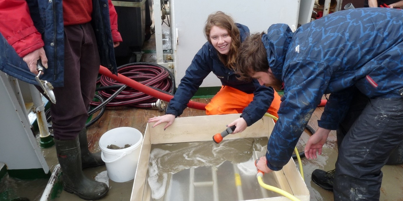
Based on the video transects, sites are chosen that are suited for box coring. A box corer is a sampling tool for sediments and fauna. It is designed for a minimum of disturbance of the sediment surface by bow wave effects which is important for quantitative investigations of the benthic micro- to macrofauna, geochemical processes, sampling of bottom water or sedimentology. Once the box corer is back on board, sediment cores are taken and the remaining sediment is sieved and all fauna is collected and examined.
Blog 2 by Sabine Haalboom, 19th May
In order to study the role of deep-sea canyons as conduits for lateral transport of organic carbon, we focus on the two most Eastern branches of the Whittard Canyon. As a PhD-student at NIOZ with a main focus on near-bed processes controlling the transport of (re)suspended particulate matter, I’m interested in turbidity measurements recorded during CTD casts and current speed profiles of the water column. During CTD casts, different kinds of optical backscatter sensors measure the amount of total suspended particulate matter (TSPM) in the water column. In order to retrieve the concentration of TSPM and to calibrate the turbidity sensors, Niskin bottles are closed to collect water samples at different depths for further filtering over pre-weighed polycarbonate filters to determine the total particle flux. Another part of the water sample is stored at 5 ̊C in order to let all the material settle for later grain size analysis back at NIOZ.
Yesterday we have deployed a BOBO lander, which will stay at the seafloor for a couple of days. The lander is equipped with different acoustic and optical backscatter sensors, which will also measure the turbidity and current speed near the seafloor, hopefully revealing the effects of tides on the particle transport in the canyon. Finally the turbidity data will show us where the highest amount of total suspended particulate matter is found in the canyon and combined with current speed profiles, we aim to reveal which processes drive the transport.
Blog 1 by Dave Price, 17th May
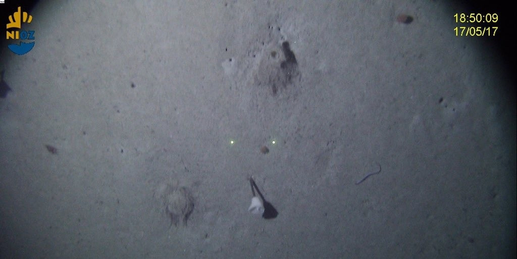
 I am a deep-sea biologist/ecologist based at the National Oceanography Centre, UK. My PhD topic focusses primarily on Cold-water coral reefs found within the Whittard Canyon complex. I’m interested in how the physical environment influences coral distribution and why some areas harbour extensive reefs, whereas others only patches of reef – so I’m keen to look at the oceanographic parameters near these areas. I’m also curious as to how and why the surface complexity induced by the coral influences biodiversity, I’m hoping video data collected on board may help reveal all. So far on this cruise (17/05/2017) no coral reef structures have been observed, though some beautiful gorgonian colonies were observed on exposed hard substrate via the NIOZ hopper video system.
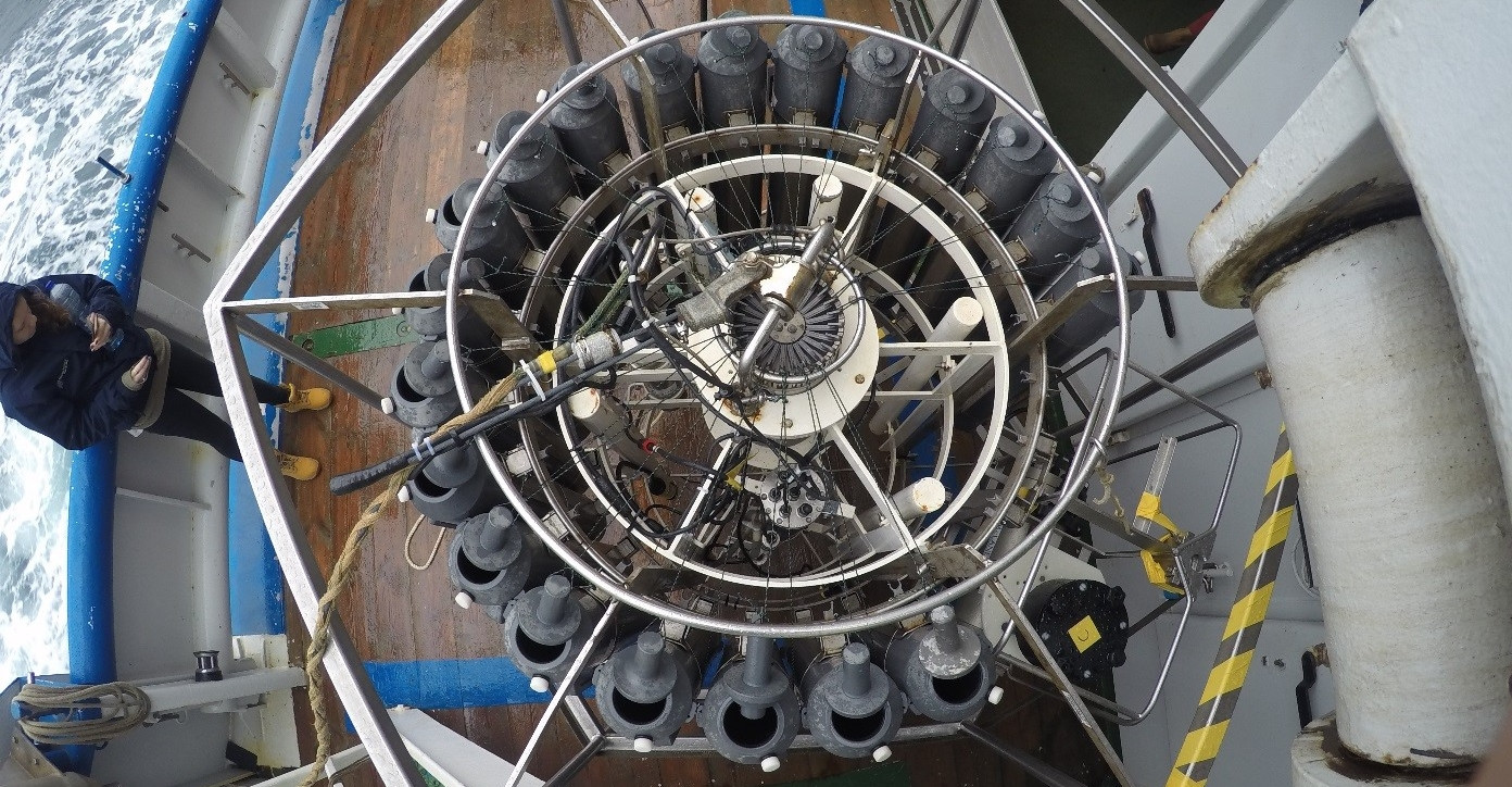
The first full sampling day consisted of equipment deployment, whereas by day two the swell had picked up restricting us to 24 hours of CTD sampling. We conducted a transect along the axis of the most Eastern branch of the canyon. The CTD rosette system (see below) is lowered down the full depth of the water column (down to ~4,000m in Whittard Canyon), to profile the water for parameters such as temperature, turbidity, salinity, oxygen concentration, density and fluorescence. Niskin bottles collected physical water samples for calibration and further analysis (such as nutrients and suspended particulate organic matter) that require processing on board.
 Furu Mienis
 Henko de Stigter
 Rob Witbaard
 Lorendz Boom
 Bob Koster
 Jan Dirk de Visser
 Sharyn Ossebaar