Digital Lab Facility
To understand how coastal ecosystems are affected by climate change, and to forecast how they will change and adapt, it is essential to collect environmental data and to integrate these into mathematical models. EDS uses a range of techniques, varying from field observations, remote sensing and image analysis, to collect large amounts of data with modern technology. Processing these datasets and integrating them in mathematical, physical and visual models for projection of the future state of coastal (eco)systems is the core business of the digital lab facility (DigiLab).
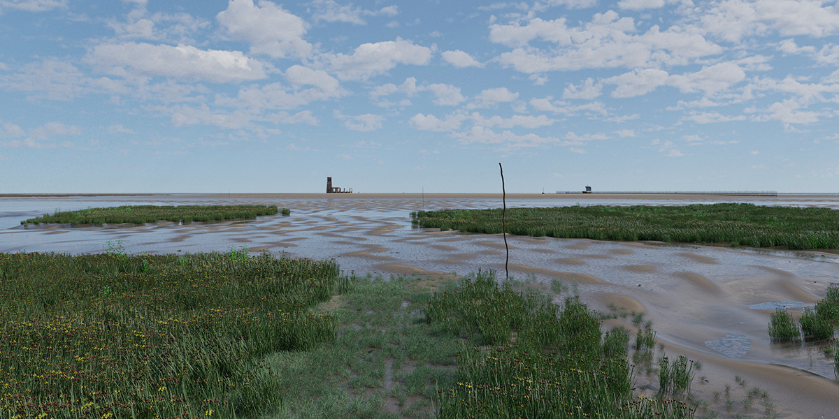
Field observation, data handling and databases
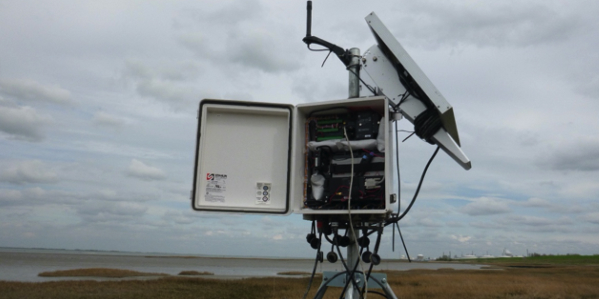
We gather extensive datasets on physical, ecological and chemical processes. These are obtained from the water column as well as from sediments, at a range of spatiotemporal scales. We operate sensors in the field to automatically measure waves, tidal currents, and sediment dynamics, and have in house workflows to process such data. In addition, long term field databases are maintained over extended time periods.
Remote sensing and big data handling
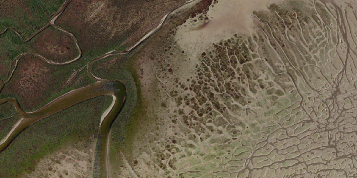
Remote sensing techniques (satellites, drones/UAVs, and cameras and radiospectrometers) provide enormous data sets. These data sets are processed using dedicated work flows into accessable information such as maps and time-series. We use supercomputers, for instance to mosaic images, and use cloud computing for big data handling. We combine spatial information in Geographic Information Systems (GIS) for spatial analyses.
Mathematical modelling
Models couple physics, chemistry, physiology and ecology. They are implemented on an ever-increasing array of scales, zooming in on the below-meter size, up to the scale of entire estuaries. They include individual organisms, but also processes driving entire ecosystems. EDS utilizes the latest computation technologies, and harbors a team of specialists in hydrodynamics, transport modelling, bio-geomorphology and ecological self-organization.
Hydrodynamical modelling
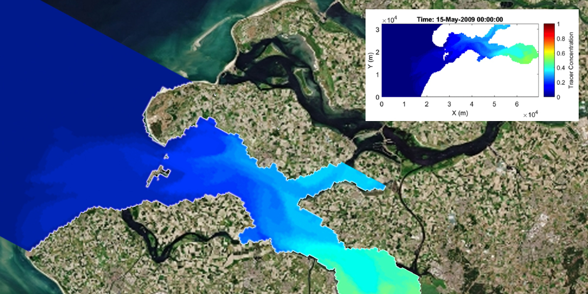
With hydrodynamic models we aim to simulate sea-level change to improve our understanding of the ocean system, its drivers and its feedbacks. This system can be global, regional or local. Modelled data can augment sparse ocean observations or provide projections of future ocean and sea-level changes with a high resolution, both in space and time. We drive our regional ocean models with information from global climate models.
Visualisation techniques & digital twins
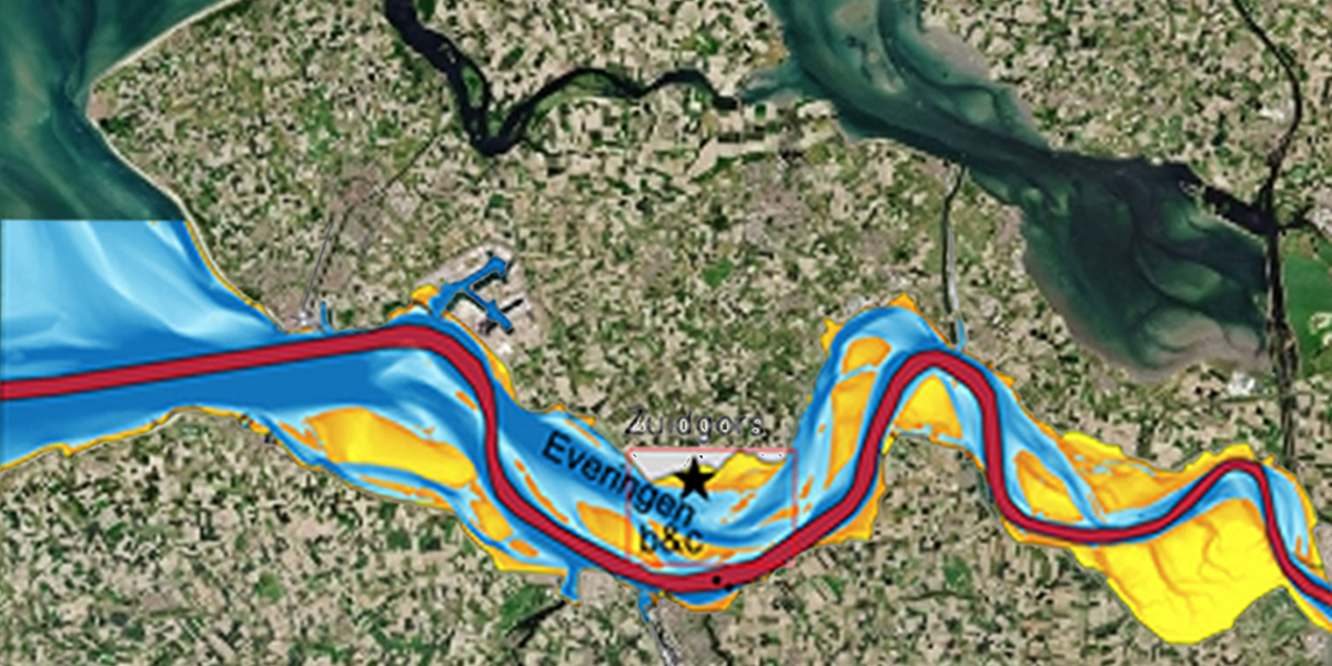
A new development in linking science and management of coastal ecosystems are the so-called ‘digital twins’. With digital twins, model forecasts are integrated with modern visualisation systems to communicate scientific understanding, historic reconstructions and future predictions to managers and stakeholders, and the general public.