Friday 12 June 2020: Where do particles go?
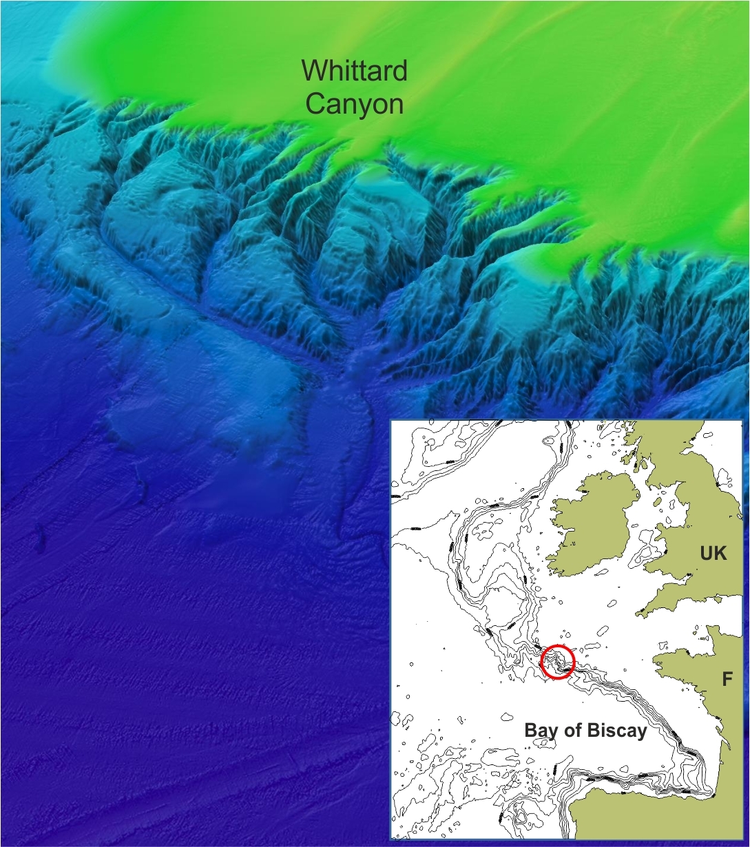
At present we are sailing with a small crew to the Whittard Canyon in the Bay of Biscay. Exactly a year ago we have deployed two moorings along the axis of Whittard Canyon at 1500 and 2200 m water depth. These moorings are used to collect data to monitor particle transport through the canyon. Submarine canyons, which are similar in size to canyons on land like the Grand Canyon, are deep gorges that incise the continental margins and act as important funnels for the transport of (food) particles from the productive shallow seas to the deep oceans.
To quantify the amount of particles that is transported and to monitor what triggered this particle transport both moorings are equipped with a current sensor, water column profiler and sediment trap. Particle transport in canyons can be a continuous process, but can also be triggered by events, like for example winter storms, plankton blooms or even anthropogenic influences like fisheries. Since we collect data throughout the whole year, we can identify which processes are responsible for particle transport and samples collected with the sediment trap will tell us how much and what type of material is transported.
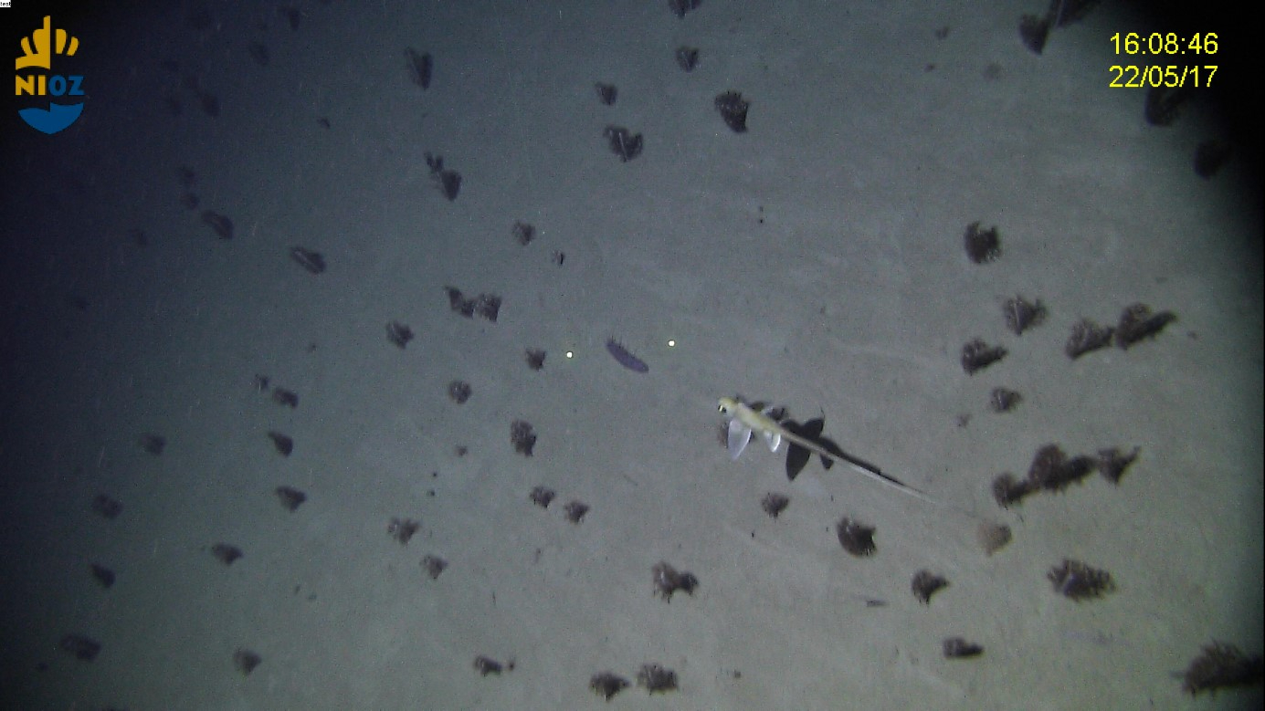
During particle transport events not only sand particles are transported, but also a lot of organic matter is trapped and concentrated in the canyon, which serves as an important food source for deep-sea fauna. Video data collected during previous cruises have indeed shown that the canyon is characterized by high abundances of deep-sea benthic fauna, like cold-water corals and fish, creating hotspots of biodiversity. In addition, if carbon is rapidly transported and deposited in the deep sea it will be withdrawn from the global carbon cycle, influencing global climate. With over 6000 major canyon systems on our globe of which only 8% has been studied so far, we are just beginning the understand the vital role of these systems in our oceans.
Friday 19 June: Entangled in the deep sea
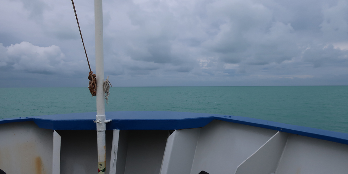
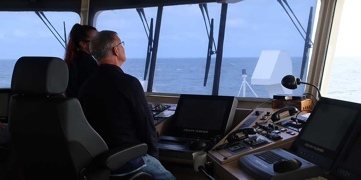
Moorings are stand-alone systems and when deployed for over a year there is always a chance that you will not get them back, especially in a dynamic environment like a submarine canyon. The closer we get to the study site, the more nervous and excited we get, will the weather allow us to recover, will we get our equipment back, and will the instruments have collected data?
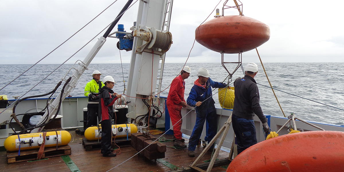
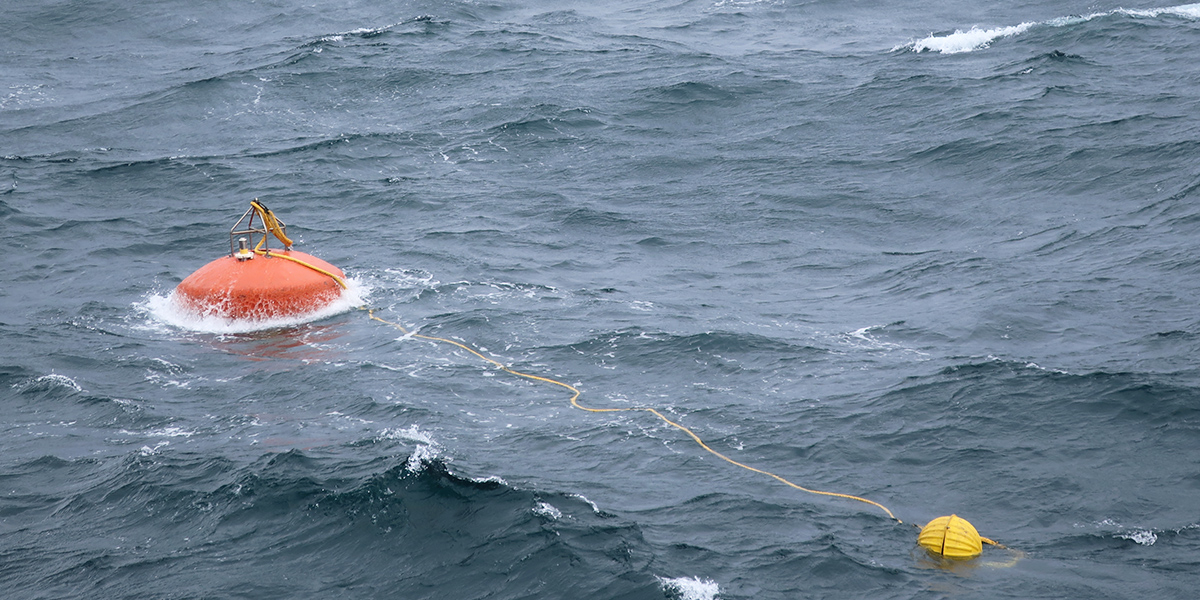
Upon arrival a large depression was in the way with lots of wind and waves, so we decided to wait for a day. The next day the weather improved, and we started with the recovery of the first mooring, which was deployed at 1500 m. After sending out the release command (a specific acoustic signal), the releases immediately responded, and we rushed to the bridge to lookout for a floating orange buoy. Luckily it appeared after 10 minutes and the vessel sailed towards the buoy and one by one the instruments were recovered without any problems, big hooray! Up to the next mooring, which was deployed even deeper at 2200 m water depth.
Stuck in a fishing net
Fortunately, the releases of the second mooring immediately responded, however it did not move at all, which meant that something was keeping the mooring at the seafloor. What to do next? We had two options, either to wait and hope that it will come up by itself or dredge for it. Since the light was already fading, we decided to wait for the next morning to dredge it. In the morning two weights were placed on the seafloor with a cable of 200 m in between. Our hope was that by sailing in a circle around the mooring location with the vessel, the cable would at a certain point get in contact with the mooring cable, pulling it out of place as close to the bottom as possible.
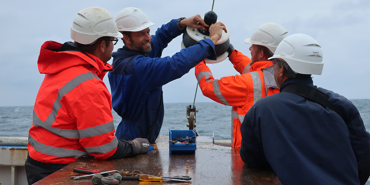
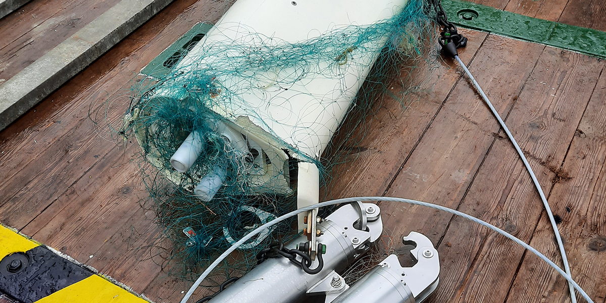
At a certain moment after we all had given up we started to receive messages from the satellite beacon that was attached to the mooring buoy. We were all anxious to see if all instruments were still there and also to figure out if we would get the clue why the mooring was stuck. One by one the instruments were retrieved including a piece of fishing net. This net was entangling the releases at 2200 m water depth, prohibiting the mooring from coming back to the surface. We only had one chance to dredge for the mooring and we were extremely lucky that it worked out, an amazing team effort of all on board! Now I cannot wait to get back home and analyse the data!
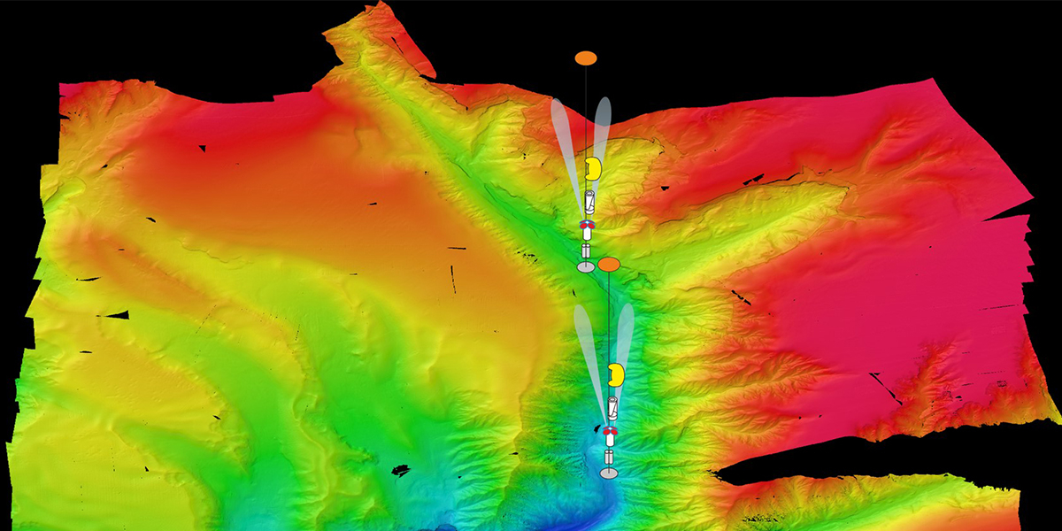
Mooring configuration
The moorings that were deployed in Whittard Canyon consisted of a more than 1000 m long cable that is anchored to the seafloor with a very heavy bottom weight and which is kept upright by a floatation sphere (aka smartie as they resemble the little chocolates). At different depths along this cable instruments were attached to measure current speed and direction, temperature, salinity and the amount of particles in the water column. The amount of particles in the water column was measured with a profiler, a unit that travels 1000 m up and down the cable every day. This data will show how often particle transport events take place during the year and if these episodes of particle transport are recorded at both depths in the canyon.

 Furu Mienis