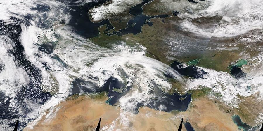
On the satellite image below (credits: NASA's eosdis website) one can barely see how dust is being emitted from Lybia. The clouds that are circling around the low-pressure cell centered above the island of Sicily obscure the view a tick but a vague brownish-orange colour can still be discerned.
Next to observations of dust from satellites orbiting the earth, there are dust models that forecast dust outbreaks and their likely pathways.
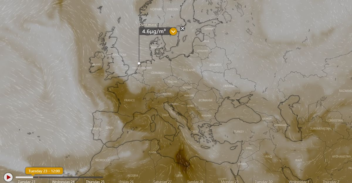
On the website windy.com, dust outbreaks can be monitored and their trajectory followed.
On the image below, the core of a Saharan-dust outbreak has just reached the Lybian coast and is moving northward. The model even provides numbers of particle concentrations. The flag is positioned on the island of Texel, the Netherlands.
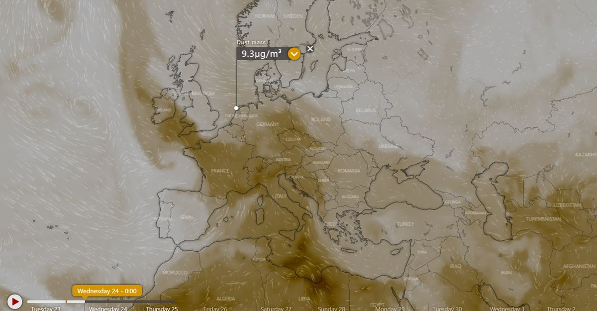
On the images below, projections are shown for the most likely path that this dust outbreak will follow. Unless rain showers wash the atmosphere clean, this dust may make it up into Scandinavia!
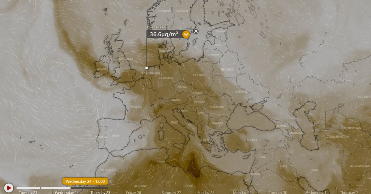
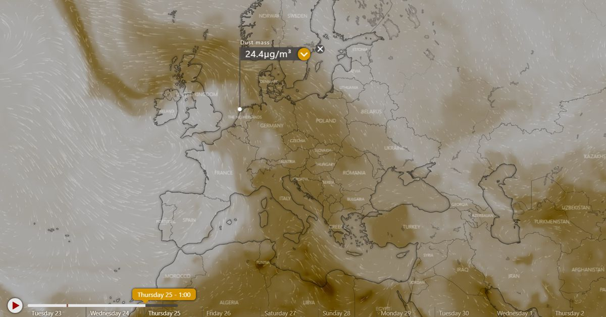
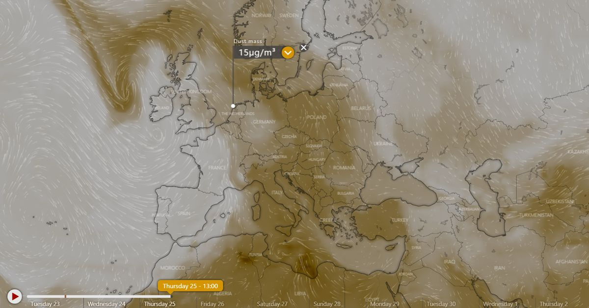
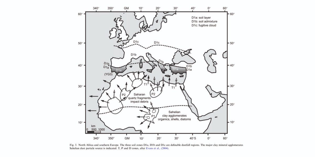
Saharan dust reaching northern Europe occasionally happens and there are even records of dust deposited in ombotrophic (from the clouds only) peat bogs. These marshes only get sediments delivered into them from the air; either by gravity or --especially when far away from the source(s)-- by rain and snow.
For more info, please refer to a paper that we published in 2009:
