Model set-up
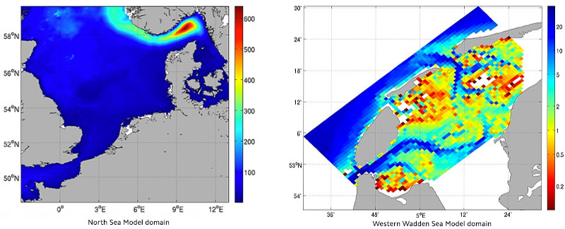
To run a hydrodynamical model in the North Sea and the Wadden Sea a 3d-grid structure is needed.
The grid number in the vertical direction (z-direction) stands for the number of layers in the pelagic. The grid numbers in x-and y-direction determine the area (model domain) which is modelled. The info about area is described in the bathymetry file. In this bathymetry file a horizontal grid is defined with properties at each grid point on its geographical position and its depth.
Using the same model code
The hydrodynamical model calculates the transport of water and the (chemical and biological) constituents in the model between the horizontal and vertical grid points. In a coupled hydrodynamical-ecosystem the chemical and biological (sub-)models calculates the local changes in each grid point and in each layer. From this follows that for modelling the ecosystem dynamics in both area the same model code is used.
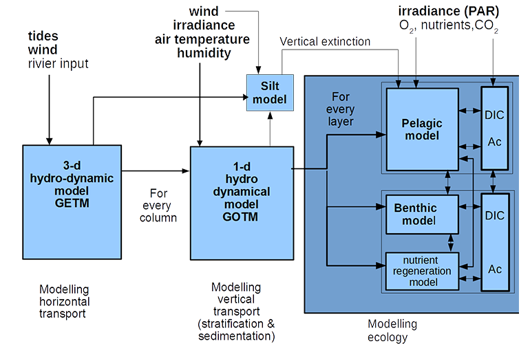
Figure above: Coupled hydrodynamical-ecosystem model