BLOG 6 | Water flow
Fluid dynamics affect multiple ecological parameters in every marine ecosystem at any spatial scale. Sessile coral-reef organisms with limited or no mobility depend on water motion for their basic functions such as food supply and waste removal. Large-scale circulation patterns determine rates of dispersal across the reef while microscale turbulence influences the mass flux on the scale of individual coral polyps or associated microbial community. These flow conditions become increasingly more complicated when water approaches a boundary (e.g. reef framework, coral surface). Water molecules directly next to a boundary stick to the boundary rather than slip by it11, creating a velocity gradient known as the boundary layer. The extent of these boundary layers determines the transfer of molecules between the water column and benthic organisms and influences the residence time of solutes in the system.
Understanding the fluid dynamics, and thus the rates of dispersal and dilution of molecules or particles and the timeframe relevant for these processes, is pivotal to determine the ecological significance of the proposed metabolic mechanisms underlying benthic phase shifts.
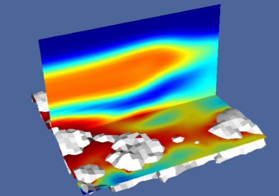
We performed underwater experiments where fluorescine, a powerful but not harmful dye, was released in proximity of corals to investigate the nature of flow. Cameras were used to record the dispersal of fluorescine through advection and diffusion. The comparison between the recorded videos and the numerical models based on computational fluid dynamics will help us to understand the physical processes at microscales.
Blog 5 | Wave measurements
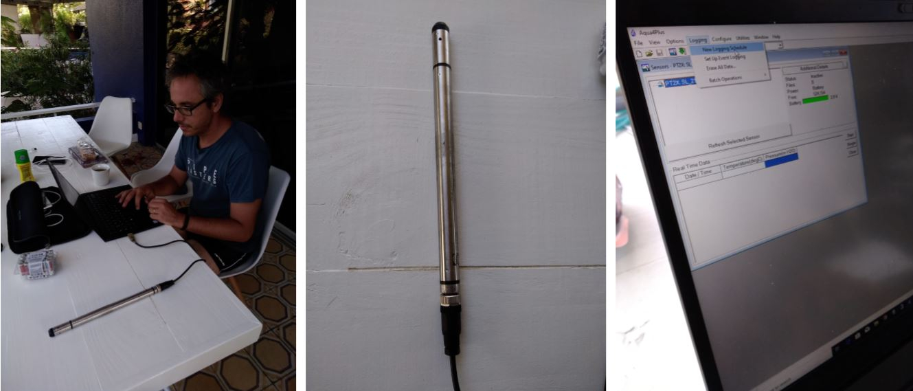
Shallow water corals are strongly affected by the action of waves. We measured the wave climate of Piscader Bay by means of bottom pressure recorders (BPR). BPR measure that change of water pressure as a result of mean sea surface fluctuation. When sampled at low frequency, BPR can used to record tides. When sampled at high frequency they can be used to record waves (height and period). We deployed 5 BPR along a transect from -10 to -1.5m of depth and we let them record for 24 hours right during a small storm event, which was capable of generating waves from SE direction. We will use the wave time series to calibrate our hydrodynamics models and to reconstruct the orbital bottom velocity which is the primary mover of water flow at the coral level.
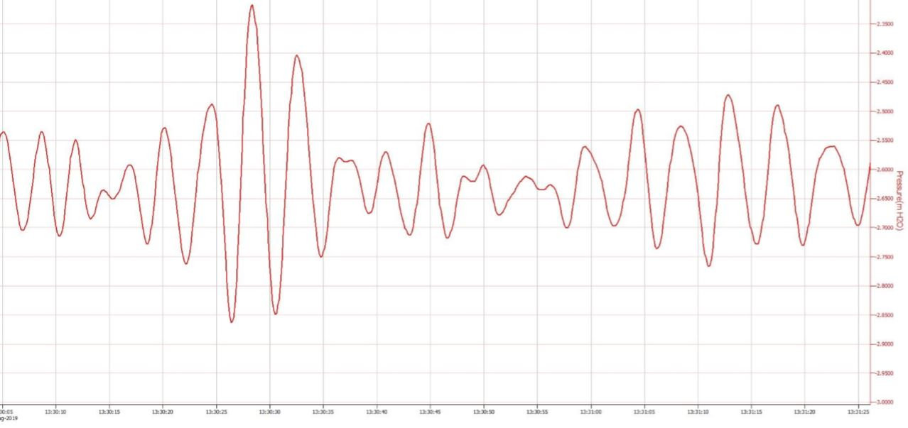
A short sample reveals the the wave climate of the shallower site in Piscadera Bay. Wave sets (4 waves of more) are visible as well as the effect of backwash in between sets. The latter shows up as asymmetric wave crest and indicates the reflection incident waves against the coast.
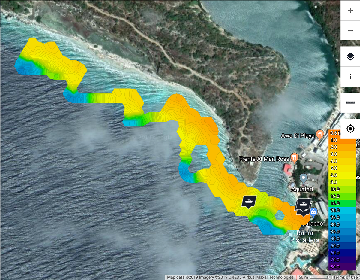
BLOG 4 | Bathymetry mapping of the Piscadera Bay area
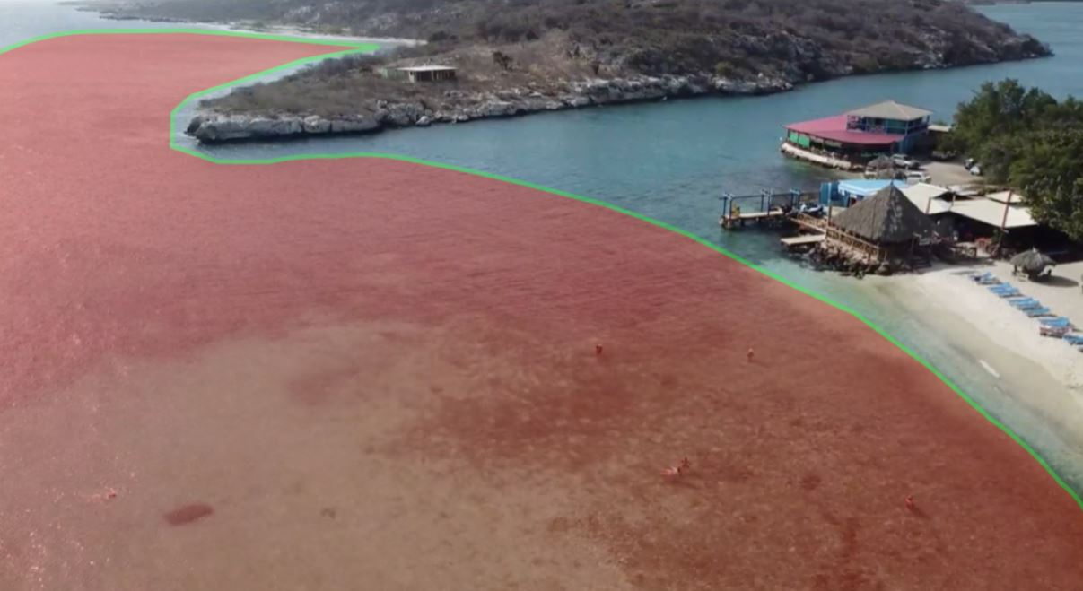
Two permanent coral-reef monitoring stations are located in the Piscadera Bay area, in the proximity of the CARMABI research station. One of our main aims was to construct a detailed high-resolution bathymetric map for the area (see red shadow on the picture below). A bathymetry map is needed as boundary condition for our hydrodynamics and biophysical numerical models.
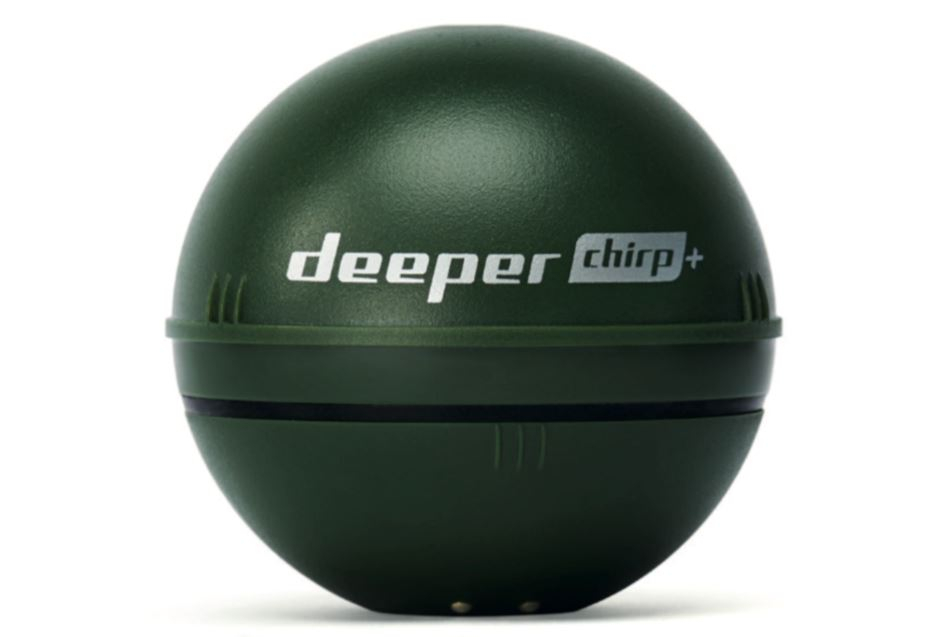
We used a commercial sonar that is normally employed as fish-finder by fishermen.
The “Deeper smart chirp+” sonar allows for a detailed reconstruction of the bathymetry down to 100m of depth. It can be towed by boat and by any other moving floating vehicle
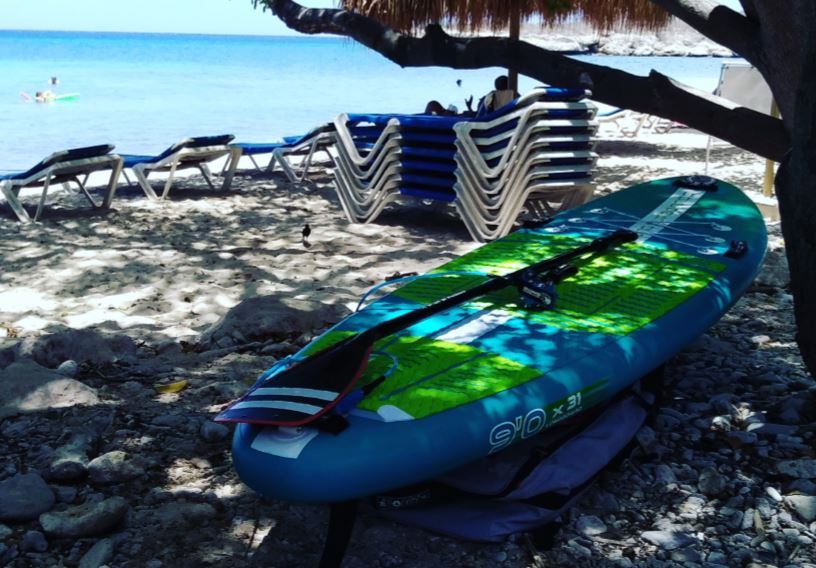
We used an inflatable Stand Up Paddleboard (SUP) as vehicle. SUPs allow for a slow and smooth cruising over extremely shallow areas covered by corals.
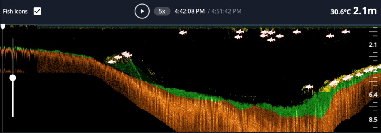
The deeper sensor is connected via wifi to a smartphone and delivers in real time 2D images of the bottom profile. The acoustic waves can penetrate the bottom and allow for the imaging of the stratigraphic structures. Also, the sonar can detect fish and other animals moving.
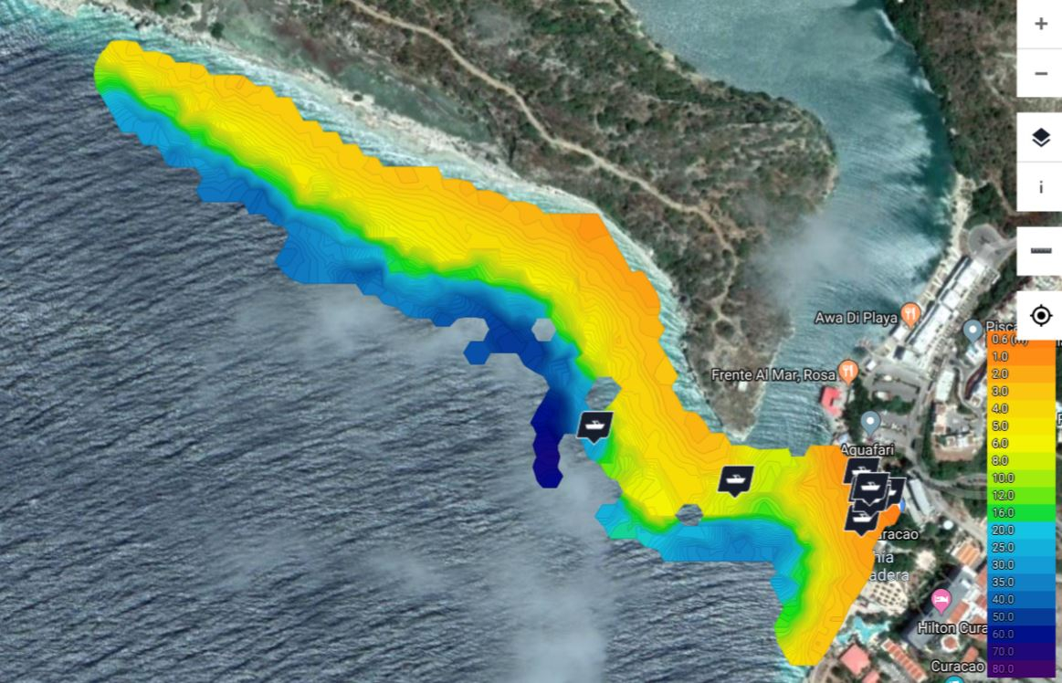
Several along-track measurements were performed during one week. Interpolation, merging and smoothing techniques were used to generate a bathymetric map for the area of interest.
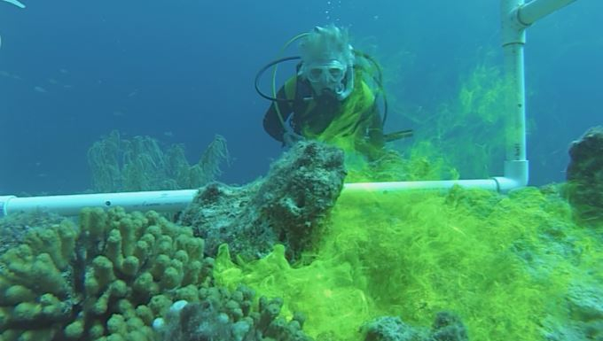
BLOG 3 | 2 september 2019
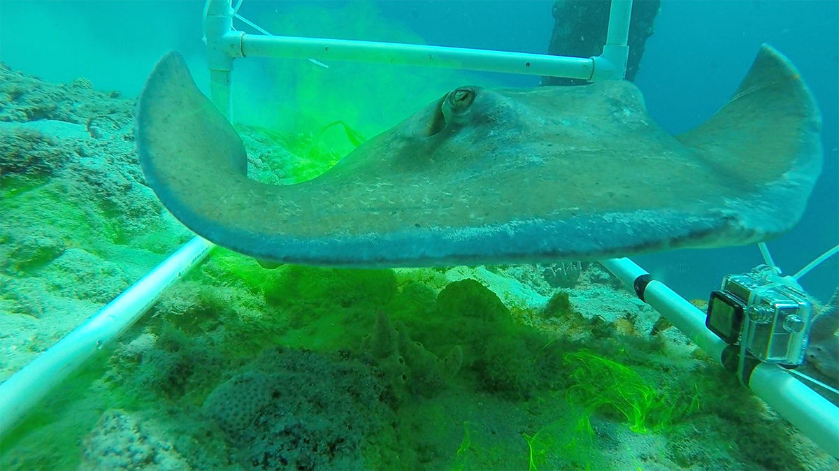
Fleur and I were in the water just in front of CARMABI to perform experiments aimed at understanding the water flow around corals, algae and microbial mats. Fleur was releasing fluorescine (green dye) when two stingrays started fighting and one of them was very territorial and did not like us in there. The stingray was circling Fleur and then all of a sudden went through the camera frame right in the middle of the fluorescine cloud. Here is a snapshot of that very unique moment. More video will follow later.
Paolo Stocchi
Blog 2 | 29 August 2019
The first results of our bathymetric survey done with portable sonars and Stand Up Paddleboarding. We are aiming at covering the whole area with data, if the weather cooperates.
Paolo Stocchi
Blog 1 | 28 august 2019
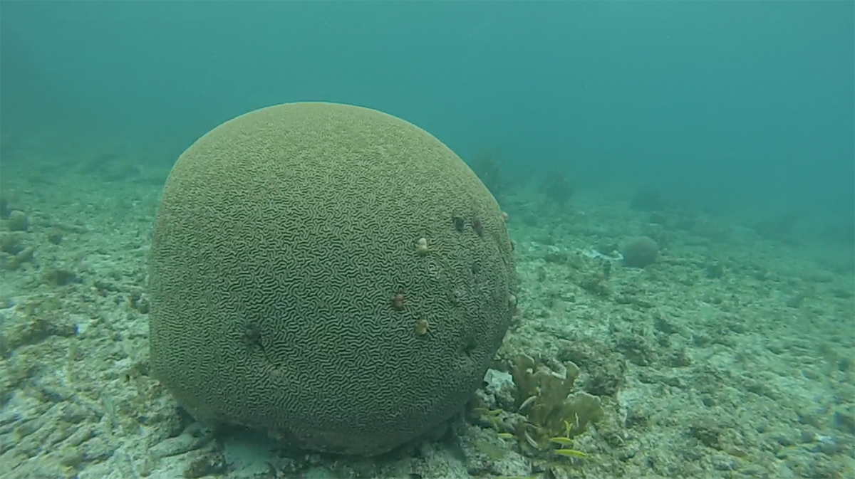
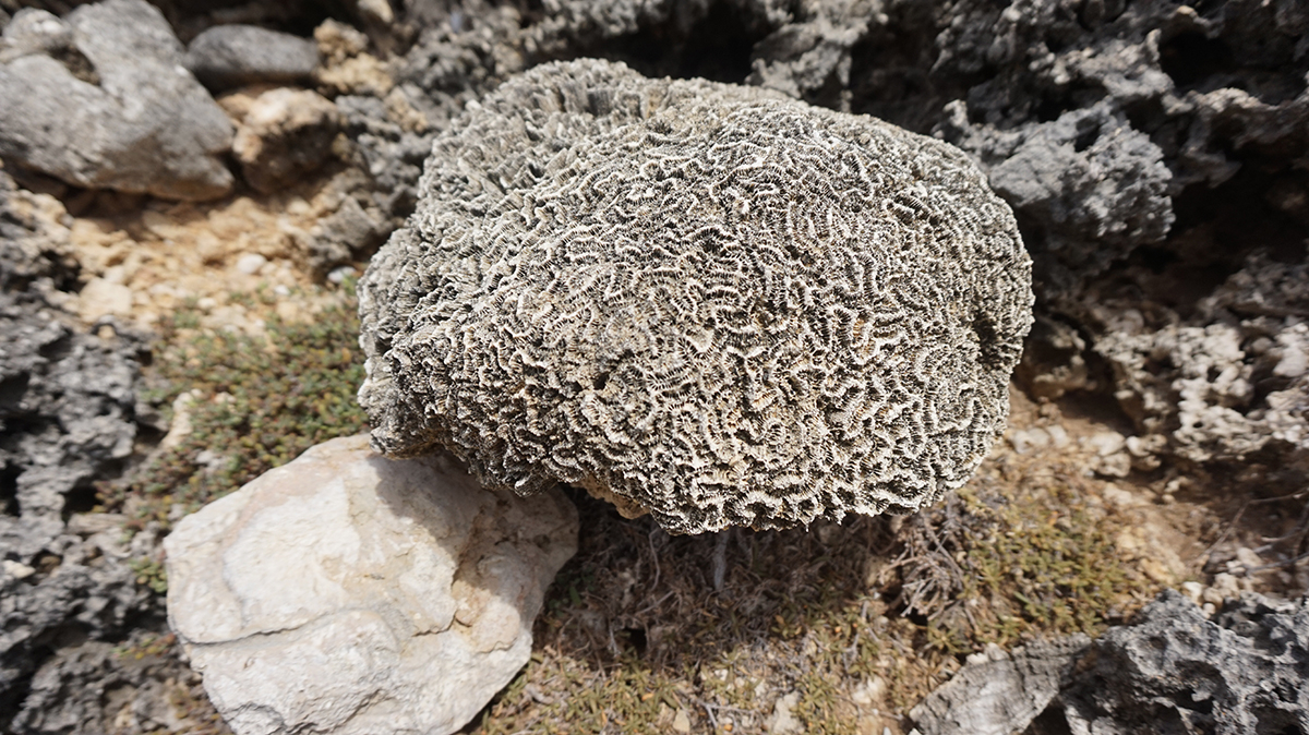
Modern vs Paleo corals
A few pictures showing a modern living Diploria found at -2m below sea level, and its ancient predecessors (grand grand grandma!) found at 5-10 m above sea level in Curacao.
The latter were alive during the Last Interglacial Stage (125,000 years BP) when Antarctica and Greenland ice sheets retreated (because of warmer climate) and cause mean sea level to rise up to 10 m above present.
Paolo Stocchi
 Andi Haas