Belgian-Dutch Geopark Scheldt Delta officially receives UNESCO Global Geopark status
The Belgian-Dutch Geopark Scheldt Delta has officially received the UNESCO Global Geopark label. This means that UNESCO considers the Scheldt estuary area so unique in geological, cultural-historical, and landscape terms that the region may now call itself a UNESCO Global Geopark and has been included in the international UNESCO Global Geopark Network, alongside, among others, the black volcanic beaches of Lanzarote, the geothermal activity of Iceland, and one of the world’s deepest canyons: Colca Canyon in Peru.
50 million years young
The current landscape of Geopark Scheldt Delta tells a story of 50 million years of subsidence and uplift, of rising and falling sea levels, of tidal waters, rivers, and climate change. It also shows the changing role of natural processes and human influence over the past two thousand years: the Delta Works, clay pits for the brick industry, peat extraction for energy and salt, logging for construction, controlled flood areas, and so on.
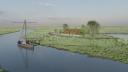
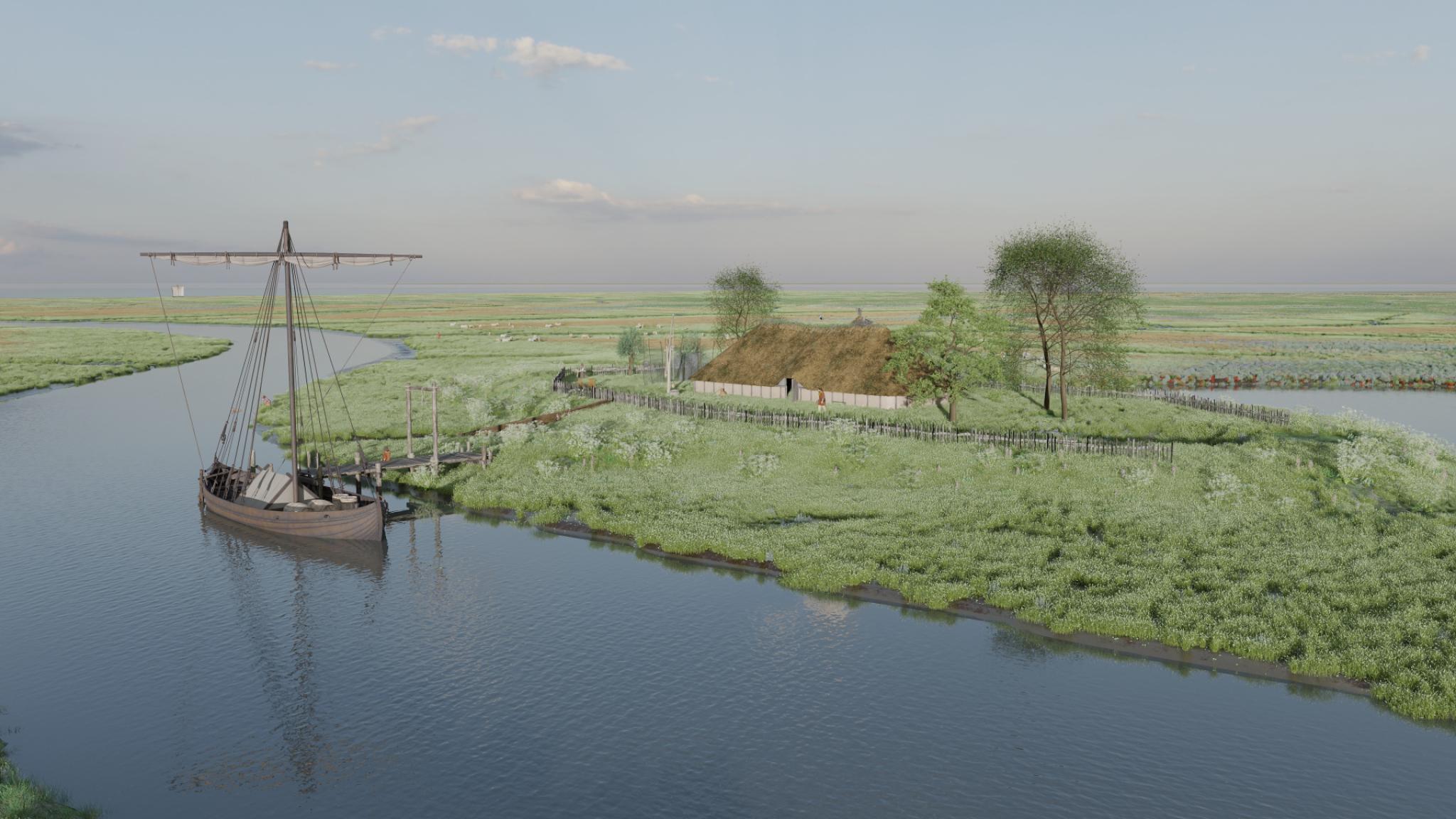
Wonen op een terp op een klimaatbestendig schor. Johan van de Koppel, NIOZ
Visualizations of the historic marsh landscape
Researchers from NIOZ are closely involved with Geopark Scheldt Delta. They study how the estuary and its ecosystems have developed over the past millennia. They also create 3D visualizations of what these ecosystems looked like, and what role humans played. “In the past, people were forced to live more in harmony with nature than is the case now,” says NIOZ researcher Prof. Johan van de Koppel, who is also a member of the Geopark’s Science Chamber. “Until around 1200, people lived on an unembanked marsh landscape, which, remarkably, offered a lot of protection against high water levels, because a dyke of 1.5 meters high was then high enough.”
The 3D visualizations can be viewed online. One of them takes the form of a short route in Wemeldinge
Opens in a new tab, and gives an impression of this village in the year 1150, when people were still farming on the marsh. Another visualizationOpens in a new tab offers a view of a flooded village that is lost during the St. Felix’s Flood in 1530.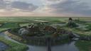
Een dorp achter een 1.5 meter hoog dijkje: het schor beschermt tegen het water.. Johan van de Koppel, NIOZ
International quality mark for geology
Recognition as a UNESCO Geopark is a quality mark that draws international attention to the geological heritage of an area and its related cultural history. This also gives initiatives for research, nature and landscape management, and sustainable tourism a better chance of receiving (European) funding. UNESCO also attaches great importance to education, local traditions, and the holistic approach of geoparks.
Linked staff
Johan van de Koppel
Research Leader

Logo van Unesco Global Geopark Schelde Delta
Logo van Unesco Global Geopark Schelde Delta