Notch at Paadje 14, Texel, six months later
In January 2025, work began on constructing a notch in the dunes near Paadje 14 on Texel. To monitor the effects of this notch on the dunes, we installed several photo posts and invite people to take pictures and send them to us. In this blog, we present the results of one of these photo posts, showing how vegetation and sand distribution are changing throughout the year.
We installed the photo posts in November 2024, a few months before the excavators started their work. This so-called citizen-science project has proven to be a great success so far, given the large number (>350!) of photos we have already received. The photo series beautifully shows how the vegetation in the area in particular is changing. It is also clear to see that in terms of sand transport, not much actually happens in the summer. Now that the new storm season has begun, things are getting exciting; thanks to Storm Amy in early October 2025, the sand body behind the notch was able to expand considerably, and thanks to Storm Benjamin (two weeks later), even more so!
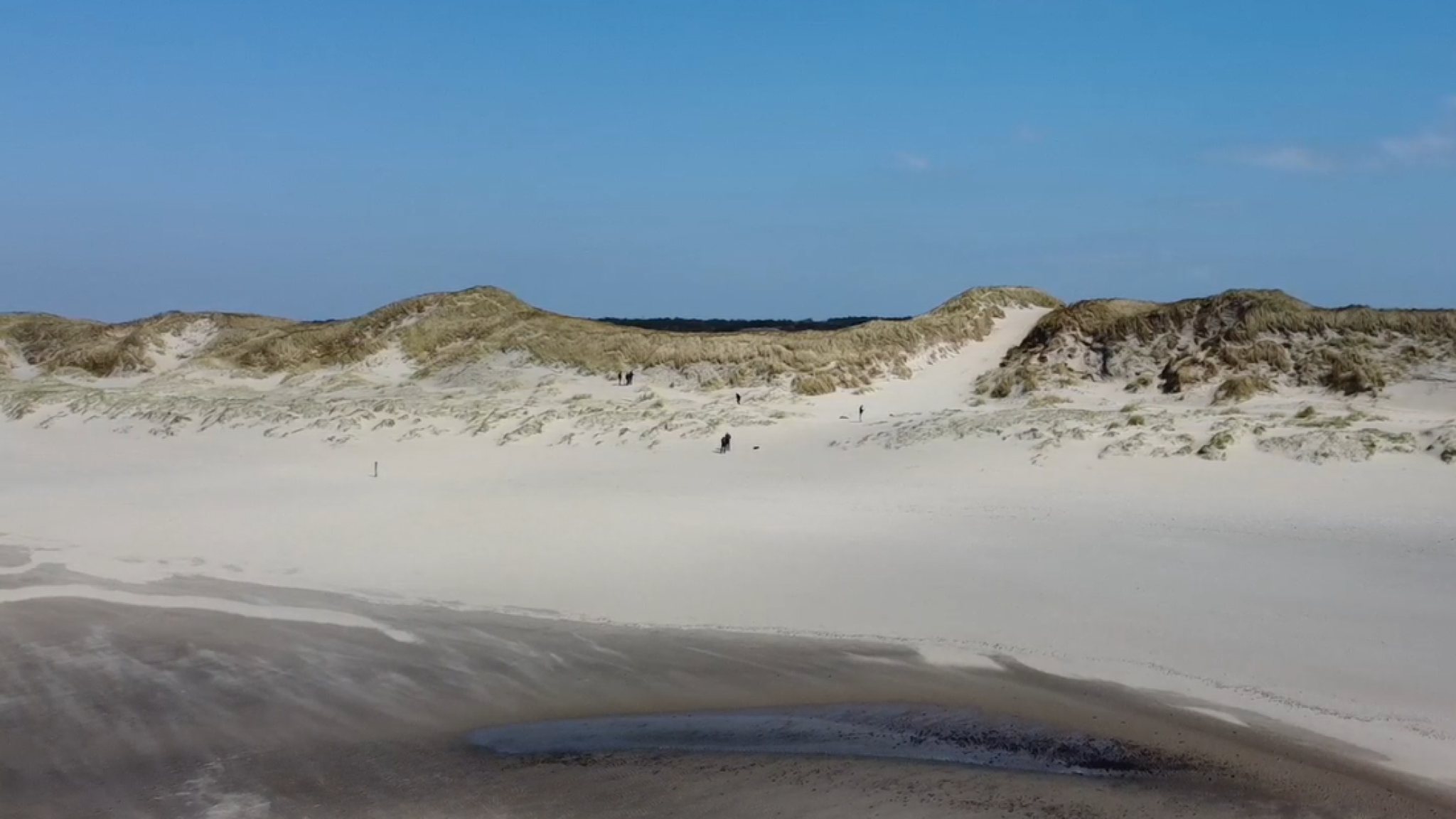
Overview photo of the area around Paadje14, taken on 28 February 2025. In the centre is the newly constructed notch.
The video clip below contains a time series of photos taken from the post placed directly behind the notch. The photos were taken by passers-by who participated in the citizen-science project.
Cookies required
Analytics and Marketing cookies are required to display this content.
Watch video in a new tabLittle sand transport in summer
The video clearly shows that, in terms of vegetation, quite a lot is happening in the area, especially during the summer period.
In terms of sand transport, not much is happening, mainly because the summer of 2025 was characterised by very calm weather. In addition, during the few days with slightly more wind, it turned out that the wind was coming from northerly directions, which was unfavourable for the orientation of the notch.
Storm season has its effects
On the other hand, storm Amy, which swept across the island in early October, did have a major effect, causing the sand lobe in the notch to expand by more than 2 metres in just a few hours! Storm Benjamin, which hit in recent days, clearly added to this.
Below are four photographs taken during the first year of the study, starting with a photograph taken by R Westra on 1 December 2024, before the notch was constructed:
Photograph of the notch location taken by R Westra on 1 December 2024
A number of people who submitted photos thought that “Paadje 14” was the notch. Although this path does indeed have the same effect as a notch, it is too small to have a significant impact. In the photo below, taken by Oeki Verhage on 25 January 2025, it is clear that the notch is being dug at that moment; the excavator is still there:
During the spring and summer, there was relatively little sand transport and many of the topped dunes were quickly covered with vegetation again. The calm weather during the summer meant that the sand traps remained virtually empty. This changed dramatically during the first weekend of October this year, when storm Amy swept across the country. The result was clearly visible in the full sand traps and also in the notch itself; a lobe formed, slightly to the right of the centre of the notch. This can be clearly seen in the last photo in this series, taken by M Houtman on 6 October 2025, just after Storm Amy:
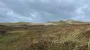
Photo of the notch location taken by M Houtman on 6 October 2025
Storm Benjamin (at the end of October) was much more powerful and lasted longer than storm Amy, which resulted in a much greater impact. The sand lobe caused by storm Amy was greatly expanded by storm Benjamin on the right-hand side of the notch:
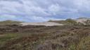
Photo of the notch location taken by JB Stuut on 26 October 2025
All the photos shown above were taken from photo post 4. There are more posts in the area, of which we will present a similar overview in this blog at a later date. The map below shows the locations and accessibility (photo pole 4 can only be reached outside the breeding season between March and August) of the three photo poles in the area near Paadje14:
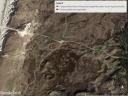
Map with locations of posts
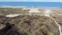
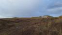
The expansion of the notch is best seen from the air. Below are three drone photos that beautifully show the development of the notch, with a small sand lobe in the middle of the notch as a result of Storm Amy and a significant expansion of a wide sand lobe as a result of Storm Benjamin:
Keep making and sharing photos
It is expected that during the current storm season, the notch will remain active and allow sand transport towards the catchments in the hinterland. We therefore cordially invite you to take a look at the area and, in particular, to contribute to our research by taking photos at the photo posts and sending them to us by scanning the QR code on the posts, or directly via: kerf14@nioz.nl
Opens in a new tabLinked staff
Oeki Verhage
Visiting PhD

Jan-Berend Stuut
Research Leader
